|
November 2009
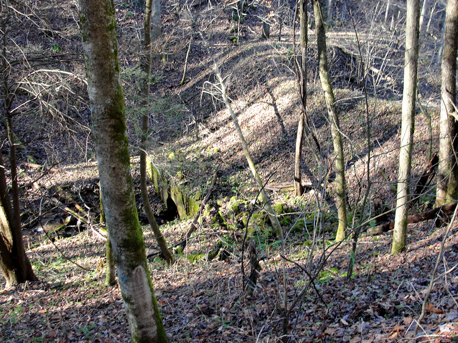
Greer Fill
This is the upper culvert for Greer Fill. The fill was taken out in the mid 50s to be crushed and used in road building in the area. The fill came from Cranberry Mine, so tailings from the mine are used all over this area, all the way from Johnson City to Boone. You can see the original profile of the fill where that small hill rises to the right. The fill when in operation was probably 60-80 feet high and 300-400 feet long. It was massive. This area is very accessible now as the Appalachian Trail goes right through here where we stand. There are several nice old photos of this fill in the open with no trees around. It's very wooded and hard to see now. There's also a good photo in John Waite's book of the gravel operation removing and crushing the rock. |