|
November 2009
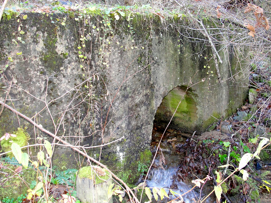
Greer Fill
Here's the bottom culvert for Greer Fill, the massive traverse of this valley on State Line Hill. Once a trestle, it was filled shortly thereafter to make a solid surface for the railroad. There's a large culvert on each side of this fill for the constant running creek to make it's way to the Doe River. Behind this fill about half a mile was Wilder Mine, a small iron ore mining operation digging out ore from the same formation of magnetite as the Cranberry Mine, several miles further east. |