|
June 1997
Map of the ET&WNC
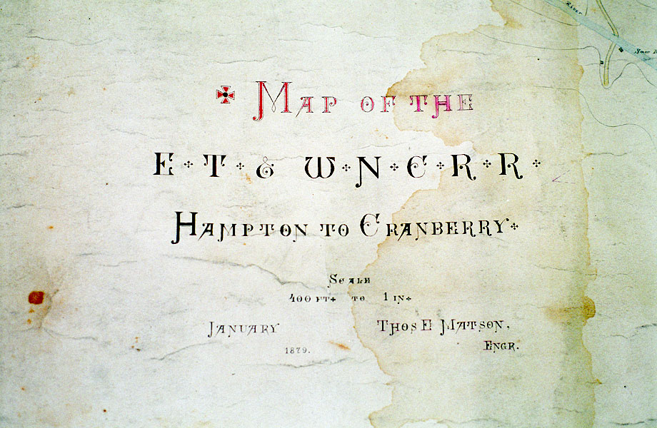
Here's a bit of history that I have actually held in my hand. It's a survey map of the proposed route from Hampton to Cranberry,
showing two choices for routes from Hampton to Blevins, one through the
Doe River Gorge, the other down Little Doe River and back up Tiger Creek
and tieing in at Blevins roughly following Hwy 19E. Most of the line that
was built pretty much follows his original proposal. The interesting thing
about this map is that it still exists, and it was done in black, purple,
red and blue inks. It's done on a heavy gauge brown (don't know if it was
white to begin with, it's so old) paper, and it's 17 foot long by 4 foot wide. It's stained in a few places and torn
on one end, but in remarkable shape for something like this that's about
120 years old. It was found rolled up in a stovepipe. It would be nice for it to be in a place to be available for
study, but the sheer size of it almost precludes that. Needless to say,
I felt honored to be able to do a little research of it for my map for
the Stemwinder of the two proposed Gorge routes and the map of the original
iron furnace at Cranberry.
|