|
June 2002
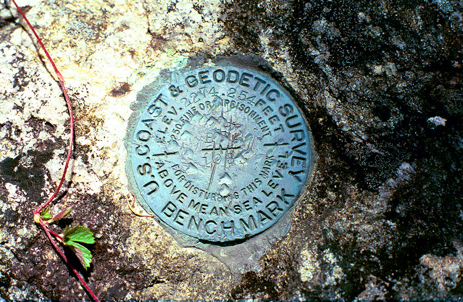
USGS Marker at Blevins
This USGS marker is set in the top of a boulder in the curve of the ET&WNC right-of-way about half way between Blevins Bridge and tunnel 5 (Sand Tunnel). If you don't know it's there you'd never see it, maybe that's why it's still there. It's number B something set in 1933
and the elevation is 2274.254 feet. These
are interesting to find and document as there are a good number
of them set into the ET and the LRRy ROW in 1933 and you can
check the elevations of the railroad easily. Thanks to the internet
and the release of USGS data about its benchmarks, it's now become
a hobby for thousands to find and document these things. Check
it out sometime.
|