|
June 1998
Montezuma
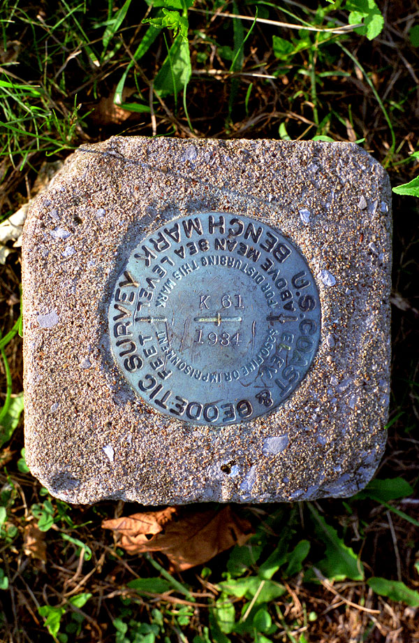
This is a survey marker on the property next door
to the house in the previous photo in Montezuma. These markers
were installed in the 1930s and each one is marked on USGS maps by
its number, in this case "K61", dated 1934, and the
on the USGS map it shows the elevation of 3837 feet above sea
level. A look at the USGS maps will reveal a multitude of these
things, with many of them along or very near the ET&WNC right-of-way.
There is one at the remaining abutment of the covered bridge
at Hampton. In this photo, up is north and the lines on the plaque
line up due east and west. Kind of amazing these markers have
survived, I guess the threat of a $250 fine or imprisonment really
works. Of course, $250 in 1934 was a lot more money than it is
now. |