|
October 1995
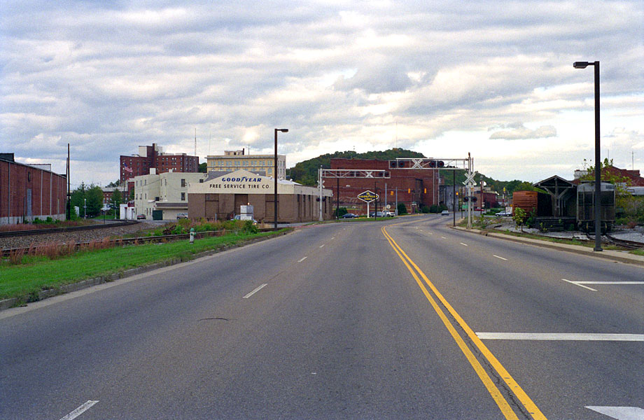
Downtown Johnson City
State of Franklin (Street, Road, Highway?) in downtown Johnson
City, Tennessee. That's the old ET&WNC station left of center with the
Goodyear sign on it. It took me a few visits to this area
to correlate my railroad maps to the current-day place. And this road is one
of the reasons. The old photos and maps always showed the dual gauge yard
and tracks in the downtown area, but now there are
only a few tracks there, and they are owned by CSX. It looks so different in this area because this road was built on top of the old dual
gauge yard. Here we are looking east towards Elizabethton from
what was basically the end of the ET&WNC trackage. The ET&WNC actually
had one track shared by the CC&O that ran down to the mill
and foundry on the right side
of the photo. That's the CSX on the right and
the Norfolk Southern mainline curving off
on the left, with a crossover track crossing State
of Franklin. State of Franklin follows the old dual gauge yard
all the way down to Division Street, then it takes a left, leaves the old railroad yard and ties in with Main Street. The backs of those brick buildings in the middle can be seen in old photos
as the backdrop for an engine or train shot. Before it was demolished for a parking lot, the old Southern Depot was beyond those trees on the left, close to the tall building in the distance.
|